|
|
|
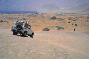
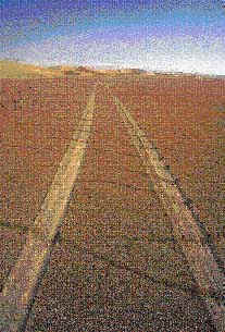
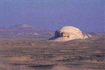
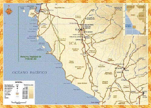
Lima is hard to leave. The various deities and demigods must be propitiated first. Today there were mysterious packages and envelopes to be dropped off, vital keys to be left somewhere, a dog to cuddled, someone’s granny to be kissed goodbye, and a construction foreman needing funds for cement. So it went: stops in San Isidro, Miraflores, Barranco, until at last we were on the Panamerican highway, heading south After Pisco, the Panamerican pulls steadily away from the coast. At Ica it is more than 50 kms. from the Pacific. This was the blessing we sought, because if anything united the motley crew of this 1986 Land Cruiser, it was an urgent need to escape from Lima-style modernity for a while. David worked in investment banking, Rosi, in the U.S. embassy, Claudia, at a diary which someday become a novel, while I, the last, toiled at various rogue enterprises, among them photography and the writing of tales. Beyond Ocucaje, as the Panamerican peeled away south-eastward, we took a turn-off that maintained our southerly drift along the valley of the Rio Ica. The change was abrupt. Now we were following tracks that wandered across hard-pack desert. They were well-used and wide, but meandered in every direction, splitting at random. They were used mainly by fishermen who patrol the coast, inshore netting and diving. There are no maps to these routes. Even local people tend to get lost. We were been joined by Alberto Benavides, another committed escapee from civilization, with his late-model diesel Toyota pick-up. Now we were five. Six, if you counted Wayra, his trusty hound/best friend. We stopped for lunch at Alberto's desert retreat in the Ica valley, and pressed on across the desolate landscape, aiming for Puerto Caballas, near the mouth of the Rio Ica. We found plenty of car tracks, but one after another they came to a dead stop at the edges of steep escarpments, or in fresh mounds of impassable sand. This continued all afternoon, while precious fuel vanished in smoke.
They were divided as to whether we could get much further north by driving along the beach. Some said yes while others interjected that there were impassable dunes Punta Olleros. We elected the optimistic advice, and set off with the raging wind at our rear. Cleaving to the narrow strip where ocean meets beach, we drove northward flat out barely outrunning the grip of the soft, clingy sand. We crossed the dry mouth of the Rio Ica as night fell. This river rarely runs, and only for brief periods during the Andean rainy season. Had we come three months later we could not have crossed it at all; during the El Nińo of '97-'98 it became a muddy torrent, flooded the city of Ica, and rushed madly to the ocean for three long months. At last we found a northbound passage through the hills, and later still spotted a patch of dull green in the distant north-east. "That's Puerto Huamaní" yelled Alberto: his retreat in the Ica valley; the very same place where we ate lunch yesterday. The next day, having refueled, we struck out again, in a less ambitious effort reach the coast at Punta Lomitas, some 25 air kms. North-west. This time the route was fairly clear, bounded by a broad valley. Below us and far off lay Punta Lomitas, a bare point thrusting into the ocean above white skirts of surf. We reached the beach, nursing a reasonable suspicion that we could proceed unimpeded for some distance north. We were using Ricardo Espinosa's guide, Peru a Toda Costa, which indicated that a good part of this route was "only for the Experienced,´ and that an impassable stretch of dunes would block our way at Punta Azua, some 20 air kms. north. But Espinosa's guide was written for those traveling north-south. The prevailing south-westerly winds created a gentle southern gradient to the dunes, while leaving a steep drop-off at the north edge. Traveling northwards, we reckoned we could climb those south slopes. If we were wrong, we would have to backtrack to the Ica valley yet again. |
|
|
|
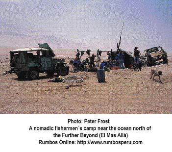
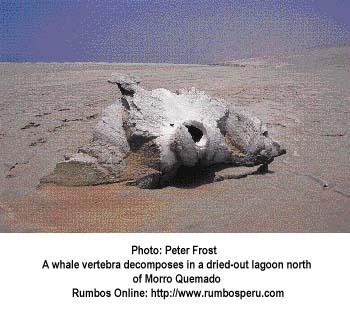
The next day we forged north, with no way out except back: a high, extreme escarpment to our right, and Pacific waves lashing our left flank. We passed a dead whale, mistaking it for a beached tree trunk, until we caught the stench of it. Continuing on, we sped by a fishermen's encampment with tattered clam divers' wet-suits hung out to dry, and severely rusted off-road vehicles parked with the hoods up. Salt-eaten hulks though they were, these cars kept running, and all the important parts worked well. The fishermen liked cars with air conditioners, so they could use the compressor to Inflate their tires. At Punta Azua we learned the importance of tire pressure. Azua is only a map name, we discovered. Local fishermen call it El Mas Allá. That had a nice ring to it: the Further Beyond. Here at Further Beyond, we were beyond civilization; beyond help; beyond the point of no return. Only the last part was true, though. All of the fishermen we met along the shoreline, Turned out to be "civilized." The storied bandits and assassins had taken a vacation. The first thing that happened here was the arrival of a party of fishermen to help us. They took over the whole enterprise of getting us across the dunes, showing us the best route, and driving one of the cars for us. They also reminded us to let our tires down to 12 p.s.i. or so, for better traction on the sand.
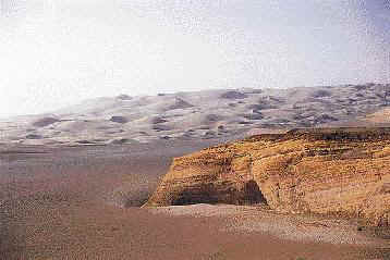
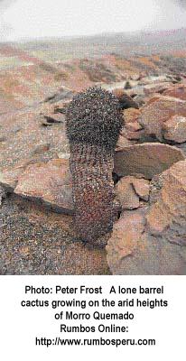
Next day we crossed the Morro Quemado passage, an easy ascent, a hair-raising descent. The cars slithered down the half-kilometer of sandy chute at the north end of the Morro, with someone hanging out the window to check that our front wheels were pointing forwards; in soft sand, the driver cannot tell. Night was falling as we reached Laguna Grande, a large inlet on the south shore of the peninsula called Punta Carretas. Two large fishing communities occupy the shores of this bay - different from the small fishing camps we had seen hitherto. Doubtless that they could effectively control their quota of ruffians, we pushed on north into the dusk in search of a better place to camp. But the track led away from the beach, and stayed there for twenty dismal kilometers . In moonless dark and deep existential gloom we finally arrived at Mendieta bay. The moment we hit the beach, we bailed out at the first likely spot, and Spread our mats behind a windbreak formed by the pick-up. This was how we had slept every night. Tonight I suspected we had bivouaced below the tide line, but the majority voted for sleep at any price.
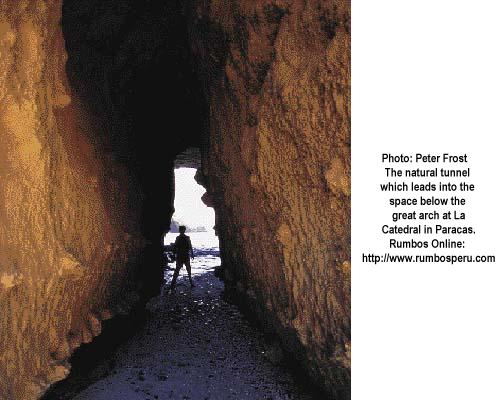
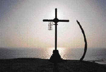
Sure enough, around three a.m. my antennae informed me that the ocean was about to engulf our camp. I awoke and raised the alarm, just as the first wavelet lapped at Alberto's mattress. Four reluctant campers dragged themselves awake and grumblingly loaded the cars. Wayra had not barked at the incoming waves. Why should he? No one had given him a sleeping bag. At daybreak Mendieta bay revealed itself as an extraordinarily beautiful Spot, with pinnacled arches and tall crags breaking the waves that rolled in across the bay. We were now well inside the Paracas Reserve, and we did some sightseeing as we drove on stopping to admire the arched "Cathedral" formation to the south of the peninsula, and watch swarms of guanay cormorants gathered on the rocks. From here we took the clearly marked route to the Panamerican highway. Our time was up.
We had taken five days to reach Paracas from the mouth of the Rio Ica. Hardly a rushed
trip, but still we were reluctant to leave. The desert had seduced us all.
|
|
|
|
Text and Photographs by Peter Frost
Volume III/Issue 12, Page 36
[Top of Page] ![]() http://www.rumbosperu.com
http://www.rumbosperu.com
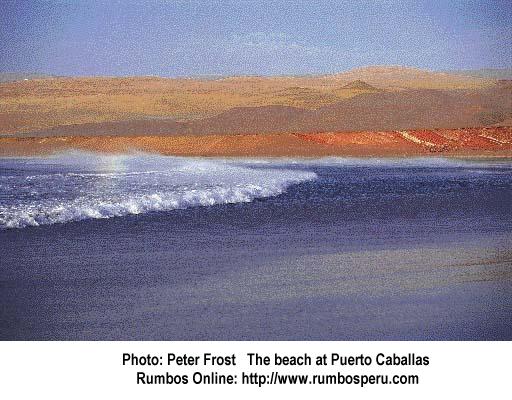
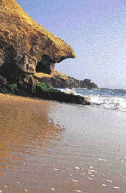 As evening approached, the distant southern end of a
long slope to the sea revealed the curved bay and scattering of fisherman's shacks at
Puerto Caballas. The promontory was besieged by raging winds and huge waves. Reaching its
shelter, we were instantly consoled by the sight of a fresh catch of lenguado. The
fishermen agreed to cook some up for us in their grubby shack.
As evening approached, the distant southern end of a
long slope to the sea revealed the curved bay and scattering of fisherman's shacks at
Puerto Caballas. The promontory was besieged by raging winds and huge waves. Reaching its
shelter, we were instantly consoled by the sight of a fresh catch of lenguado. The
fishermen agreed to cook some up for us in their grubby shack.